
 Photograph unavailable
Three cities in the Menderes valley: Nysa, Mastaura, Tralleis
Story in brief
Place, time and memory on one line.
Gorge, crossroads and slope: a sourced dossier reading Aydın's ancient cities as connected geographical scales, not one fixed itinerary.
Story layers
What does this story connect?
Nysa stretches across both sides of a deep gorge, with three bridges linking them. Its gymnasium, stadium, theatre, agora and library widen the picture from passage to public architecture. The crossings make terrain part of the city’s form, while the civic buildings show a broader urban setting.
The story line
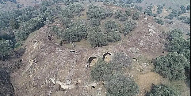
The Mastavra stream, also known as Khrysaoris, runs through Mastaura. Natural passages from Caria and Lydia meet in the wider valley context. A report dated 27 September 2022 says excavation began that July and records the discovery of external support walls, galleries, vaulted corridors and tribunes in the amphitheatre.
Where does it pass?
On a plateau along the southern slope of the Kestane Mountains, Tralleis gives the comparison a higher urban scale. The remains known as Üç Gözler belong to a gymnasium dated to the second century CE. A bath, theatre, agora and stadium also form part of the city’s public architecture.
The link to today
These places bring the basin into view at three scales: gorge crossings, a stream valley and an elevated city. At Mastaura, the 2022 excavation report offers one dated glimpse alongside the longer geographical setting.
Stops in this story
Paths opening from this story
- Continue to Miletus, where the Menderes reaches the sea: After exploring the valley monuments of Nysa, Mastaura and Tralleis, follow the Büyük Menderes to Miletus, where river silt transformed an ancient harbor city into an inland tell.
Miletos · From Miletus to Didyma, the course of water - Continue to the Lycus–Büyük Menderes connections: Heading from the Aydın valley into the Lycus basin, the river battlements of Tripolis, Hierapolis's cascading travertines and Laodicea's colonnades form an unforgettable triangle.
Tripolis · From Lycus to the Büyük Menderes: Laodicea, Hierapolis and Tripolis
Sources
Frequently asked questions
How are the stops in this story connected?
Three cities in the Menderes valley: Nysa, Mastaura, Tralleis reads Nysa, Mastaura, Tralleis together not as one mandatory itinerary, but through a shared region, period, landscape or sourced historical relationship.
Where can I see this story's sources?
The Sources section visibly lists the institutional and research links supporting this narrative. Current visitor information is added only when confirmed by a dated authoritative source.