
Tripolis
On the Büyük Menderes, at the northeastern threshold of the Lykos Plain: a border and trading city.
 Photograph unavailable
Denizli · Border and trading city
Crossroads of Lydia, Caria and Phrygia
Set beside the Büyük Menderes river where the Lycus Valley opens, Tripolis served as a vital transition between two basins, uniting Lydia, Caria and Phrygia on major commercial axes.
Water brought from 25 kilometres away
Despite its river setting, drinking water was channelled from mountain springs 25 kilometres distant via aqueducts, arches and terra-cotta conduits, feeding monumental nymphaea and baths.
Colonnaded avenues and monumental markets
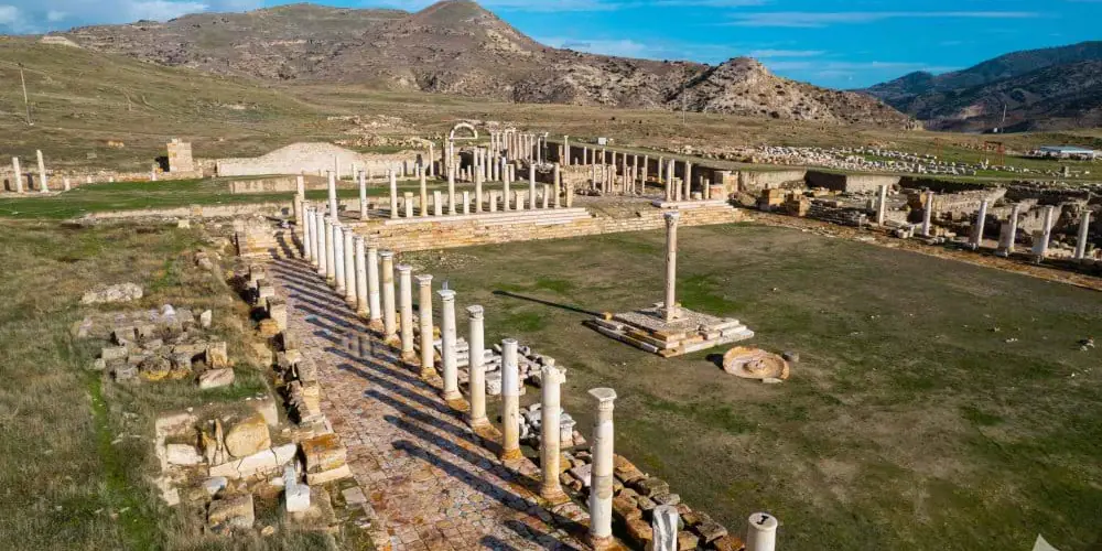
Exquisitely restored colonnaded avenues, a frescoed agora bazaar, council hall and hillside theatre reveal the opulent civic life enjoyed in Tripolis through Roman and Byzantine times.
Third jewel of the Lycus Valley
Directly connected to Hierapolis-Pamukkale and Laodicea, Tripolis completes the ancient Lycus Valley triumvirate, paired with nearby Buldan Weaving.
Gateway on the Büyük Menderes
Situated beside the Büyük Menderes in Buldan's Yenicekent district, Tripolis dazzles visitors with standing colonnaded avenues, mosaic-floored villas and a monumental agora. Together with Hierapolis-Pamukkale and Laodicea, it forms an essential ancient triangle, tied seamlessly to the textile crafts of Buldan Weaving.
Layers of the place
How is the place situated?
The official source places Tripolis beside the Büyük Menderes and at the northeastern threshold of the Lycus or Çürüksu plain. The setting makes it possible to read the city as a transition between two basins rather than as a point belonging to only one valley.
How do the layers change?
The source distinguishes Hellenistic and Roman urban layers from Eastern Roman and later-period traces. The use of historical roads across different periods does not mean that every connection operated at the same time or under one administration.
How was the place inhabited?
Roads from the directions of Smyrna, Pergamon and Ephesos converged at Tripolis and continued through Hierapolis and Laodicea toward the east and south. This supports a context of movement for travellers, goods and information, while the source does not provide trade volumes, occupational shares or continuous travel times.
What can be said today?
The ancient road context should not be confused with modern transport. Historical geography is a durable interpretive layer; current roads, safety, hours, tickets and field access must be checked through separate dated official information.
Connected stops
Stories that include this stop
Sources
Frequently asked questions
Where is Tripolis?
Tripolis is presented in this guide as a border and trading city in Denizli.
How can I find sources for Tripolis?
The Sources section links to the evidence supporting this dossier.