
 Photograph unavailable
Four place dossiers in the Inner Aegean
In brief
Four place dossiers in the Inner Aegean
Sardis, Kula Geopark, Blaundos and the Phrygian Valley are read side by side through urban remains, volcanic formations and rock settlements.
What holds this line together?
The Inner Aegean opens onto different landscape scales: the Gediz plain at Sardis, the volcanic field of the Kula-Salihli Geopark, and rock-cut settings in the Phrygian Valley. These separate places invite comparison across geological and civic timescales, rather than one continuous ancient-road story.
Three geographic readings
Sardis between plain and foothills
01 · The Gediz plain
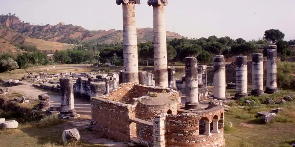
Sardis lies between the Gediz (Hermos) plain and the foothills of Bozdağ (Tmolos). It was a Lydian capital in the seventh and sixth centuries BCE, then a Persian regional centre. The shift from capital to regional centre belongs to Sardis’s own civic history.
Kula’s geological timescale
02 · Volcanic landscape
The Kula-Salihli Geopark brings the Kula volcanic field, Bozdağlar and the Gediz graben into one geological setting. UNESCO describes three Quaternary volcanic phases, dated to about 1.1 million, 300,000 and 15,000 years ago. These spans sit on a different scale from Sardis’s documented civic periods: geology and political history meet in the comparison, not in a shared chronology.
Carved spaces at Ayazini and Göynüş
03 · Rock-cut settings
At Ayazini, tomb chambers, churches and rock settlements cut into tuff stand beside old and newer settlement areas in the village fabric. The Göynüş Valley has its own group of monuments: Aslantaş and Yılantaş rock tombs, Göynüş Castle and Maltaş. At Aslantaş, a carved entrance is flanked by a lion and cub relief, with a tree-of-life motif above. The royal attribution and seventh-century BCE date are uncertain; the carved doorway is the detail to hold onto.
Connected place dossiers
1. Sardes
Manisa · Lydian capital
A threshold into the political and economic memory of Lydia in the Gediz plain.
2. Kula Jeoparkı
Manisa · Volcanic landscape
Where volcanic topography in the Gediz basin intersects with human settlement.
3. Blaundos
Uşak · Valley settlement
One of the ancient settlements to be seen within Uşak’s valleys and road network.
4. Frig Vadisi
Afyonkarahisar · Rock cultural landscape
A broad inland narrative opened through rock faces, passages and settlement traces.
Layers of time
Stories that expand this route
Planning boundary
Compare Sardis, Kula Geopark, Blaundos and the Phrygian Valley on the Culture Map. Two of the four stops currently have mapped points. The map shows a place selection, not a reconstructed ancient road or present-day walking route.
Frequently asked questions
How many stops does this route connect?
It connects 4 place narratives in one cultural reading. Open each stop card to read that place’s story.
How many stops appear on the map?
2 of the 4 stops appear on the Culture Map. The map link opens these stops together.
Is the stop order a travel itinerary?
The order helps you compare layers at different places. It serves as a reading sequence rather than directions or a visit schedule.
How can I continue reading?
Follow stop cards to place narratives, period links to the timeline and related stories to long reads.