
Kula Jeoparkı
A UNESCO Global Geopark in the Gediz Graben, where lava flows and human traces meet in one geography.
 Photograph unavailable
Manisa · Volcanic landscape
A fire-born terrain
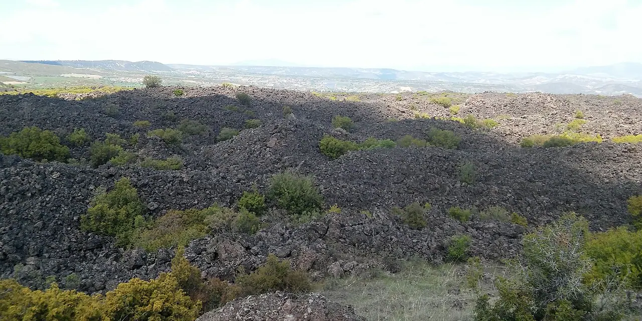
Kula-Salihli Geopark is Türkiye's first and only UNESCO Global Geopark, featuring volcanic cinder cones, basalt columns and dramatic black lava plateaus.
Geology beside culture
Traditional Ottoman timber mansions built with volcanic stone, thermal hot springs and prehistoric human footprints reveal the rich integration of nature and culture.
Katakekaumene: the burned land
Strabo called this eerie black terrain 'Katakekaumene' (The Burned Land), bearing dramatic testament to volcanic eruptions across hundreds of thousands of years.
Science, education, low-impact routes
The Divlit Volcano hiking trail and timber boardwalks provide an unforgettable geo-heritage adventure linking Sardis with Aizanoi.
Geological memory of the Burned Land
As Türkiye's first UNESCO Global Geopark, Kula is an astonishing open-air museum of volcanic cinder cones, pitch-black basalt coulees and fairy chimneys. Neighbouring ancient Sardis, it seamlessly weaves prehistoric fossil footprints and Ottoman timber mansions into a single volcanic landscape.
Connected stops
Sources
Frequently asked questions
Where is Kula Jeoparkı?
Kula Jeoparkı is presented in this guide as a volcanic landscape in Manisa.
How can I find sources for Kula Jeoparkı?
The Sources section links to the evidence supporting this dossier.