
Bergama
A multi-layered landscape above the Bakırçay Plain, from Hellenistic capital to living Bergama.
 Photograph unavailable
İzmir · Layered city
Power rising on a slope
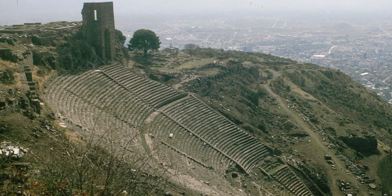
Crowning Kale Hill above the Bakırçay Plain, Pergamon reaches toward the sky with the world's steepest ancient theatre, the famed parchment library and the gleaming Temple of Trajan.
Learning, worship and healing
Beside the acropolis, the Asklepieion in the valley below was one of the ancient world's foremost healing sanatoriums, pioneering therapies using thermal waters, dream analysis and suggestion.
A city changing scale
From Hellenistic capital to Roman provincial centre, and on to Ottoman bazaars and modern Bergama, this urban continuum connects naturally with Sardis and Aizanoi.
Not one acropolis, a whole landscape
The monumental brick vaults of the Red Basilica and the vibrant historic Arasta bazaar illustrate how the ancient capital intertwines with contemporary Aegean life.
Pergamon between sky and plain
Pergamon cascades down Kale Hill into the Bakırçay Plain, featuring the world's steepest ancient theatre, the famed library where parchment was developed, and the healing waters of the Asklepieion. Its historical resonance extends across to Sardis and Aizanoi.
Layers of the place
How is the place situated?
Pergamon's hilltop settlement adapted to topographic constraints through terraces. The arrangement requires the acropolis above, urban areas on the slope and lower ground opening toward the plain to be read not on one level but as a city connecting different elevations.
How do the layers change?
The official source says settlement continued despite destruction and occupation because of the strategic position, and that the city expanded across the plain with new Roman structures. This shift between hill and lowland shows that urban weight did not remain at one point or scale through time.
How was the place inhabited?
Terraced planning required movement, public spaces and urban services to be organised across an inclined site. This spatial reading derives from the evidence for continuous settlement and topography; the source does not by itself explain one individual's daily life or every building's detailed function.
What can be said today?
Reading Bergama today begins by not isolating the acropolis image from the plain and living town. This source supports durable topography and settlement change; current entry, transport, hours and all components of the World Heritage boundary require separate official records.
Connected stops
Stories that include this stop
Sources
Frequently asked questions
Where is Bergama?
Bergama is presented in this guide as a layered city in İzmir.
How can I find sources for Bergama?
The Sources section links to the evidence supporting this dossier.