
Herakleia Latmos
On the shores of Lake Bafa, Herakleia tells the Latmos story through 8,000-year-old rock paintings, Endymion's shrine and Byzantine monasteries.
 Photograph unavailable
Muğla · Lake and rock landscape
From sea gulf to inland lake
In classical antiquity, Herakleia opened directly onto the Aegean through the Latmos Gulf. When silt from the meandering Maeander river cut off the gulf mouth—just as it did at Miletus—it birthed the mystical inland expanse of Lake Bafa, surrounded by granite boulder formations.
Dramatic fortifications and Athena's shrine
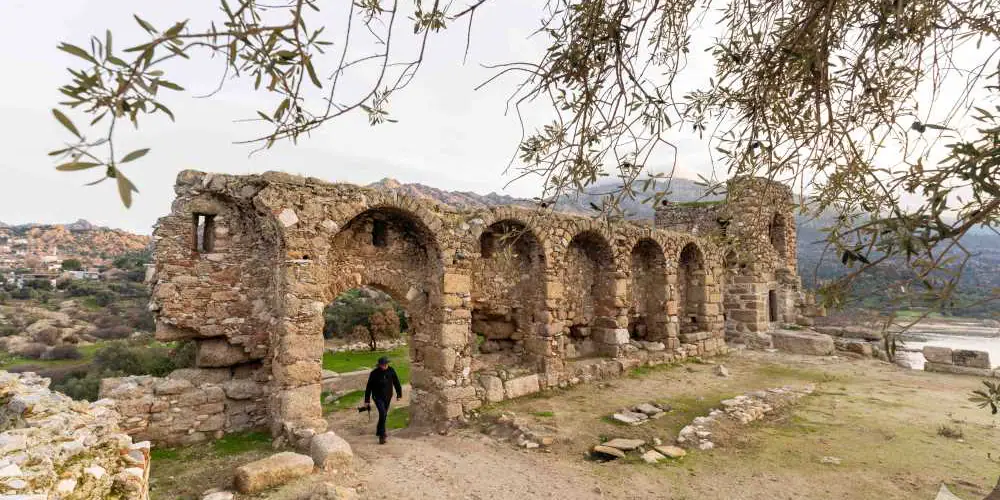
Engineered amidst astonishing granite tors, 6.5 kilometres of Hellenistic ashlar fortifications and 65 towers climb the precipitous crags. The Temple of Athena perches boldly over the lake waters, demonstrating how town and wild geological terrain were treated as connected parts of one landscape.
Selene, Endymion and hermit monasteries
Here myth relates that the Moon goddess Selene cast the handsome shepherd Endymion into eternal sleep so she might embrace him nightly in his sacred cave. In the Middle Ages, Byzantine hermits retreated to Bafa's rocky islets, decorating monasteries like Yediler with luminous frescoes.
Prehistoric rock art and village life
Hidden within the rock shelters of Latmos are 8,000-year-old Neolithic paintings depicting joyous family celebrations and community dances. Today the ruins weave gently through Kapıkırı village, providing a dreamlike mountain interlude on journeys linking Labraunda and Euromos.
Mythological home of lake and stone
With its Temple of Athena mirrored in Lake Bafa, 8,000-year-old Latmos rock paintings and majestic walls embracing Kapıkırı village, Herakleia is Caria's most magical landscape between Miletus and Euromos.
Layers of the place
How is the place situated?
The official source locates Heraclea geographically around Ionia while describing its historical character as Carian. The urban site, Latmos rock shelters and Lake Bafa are connected parts of one landscape, but they should not be collapsed into a single map point.
How do the layers change?
Rock paintings on the western slopes of Latmos are assigned to prehistoric periods, while the city is discussed through the name Latmos and later phases under Mausolus, Alexander and the Seleucids. The filling of the ancient gulf by alluvium and its transformation into Lake Bafa was a long geographical process rather than one dated event.
How was the place inhabited?
The loss of the former sea connection and the later use of difficult terrain by Christian hermits show how the same landscape served different communities in different ways. The source does not establish an uninterrupted identity between prehistoric image makers and later urban or monastic groups.
What can be said today?
Heraclea can be read around Kapıkırı and Lake Bafa, while the Latmos rock-painting sites have separate conservation and access conditions. Current trails, guiding, hours and field safety must be checked through dated official channels.
Connected stops
Stories that include this stop
Sources
Frequently asked questions
Where is Herakleia Latmos?
Herakleia Latmos is presented in this guide as a lake and rock landscape in Muğla.
How can I find sources for Herakleia Latmos?
The Sources section links to the evidence supporting this dossier.