
 Photograph unavailable
Wind, olives, stone
In brief
Wind, olives, stone
A Northern Aegean reading from the stone terraces of Assos and the waterways of Mount Ida to Ayvalık's olive coast and Pergamon's layered urban memory.
What holds this line together?
At Assos, a volcanic hill rises above the sea; at Antandros, a Roman villa sits on Kazdağı’s southern slopes. The reading widens from these settlement scales to olive production around the Gulf, then to Pergamon, where acropolis terraces follow the hillside before the Roman city expanded toward the plain. These places connect through comparisons of ground and work, not one period or continuous shoreline.
Three geographic readings
Assos and Antandros at different scales
01 · Hillside and mountain
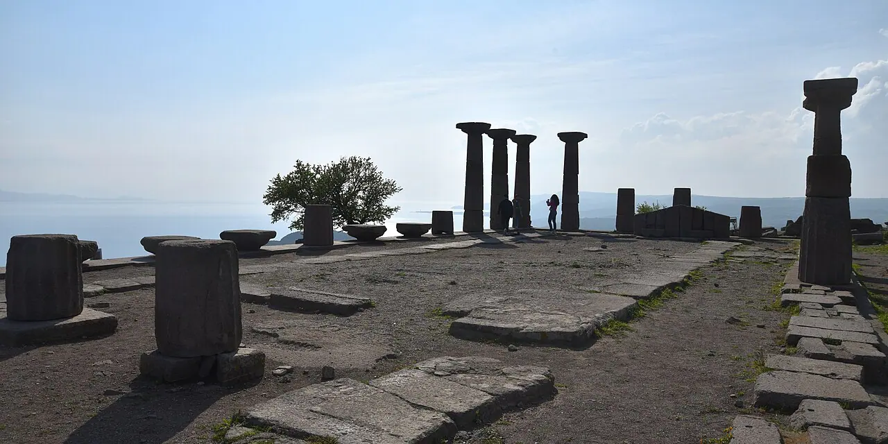
Assos stands on a volcanic rocky hill about 238 metres above sea level, with its temple, agora, theatre and other civic buildings set within that elevated terrain. At Antandros, near Kaletaşı Tepesi on Kazdağı’s southern slopes, a preserved Roman villa brings the scale down to a house: its mosaic and frescoes date to the first century CE. Deep valleys and canyons in Kazdağı National Park support forest and water ecosystems; the park covers part, not the whole, of the mountain’s wider geography.
A gulf landscape and a named oil
02 · Olive production
Ayvalık’s UNESCO Tentative List entry widens the view to olive groves, a traditional settlement and port, oil factories, workshops, warehouses and soap-making; it is a tentative entry, not a World Heritage inscription. Separately, Edremit olive oil received a protected designation of origin in 2017, with a defined production area and handling rules. One record describes an industrial landscape, the other a named product tied to geography and method.
Pergamon from acropolis to plain
03 · The Bakırçay plain
At Pergamon, the acropolis settlement developed in terraces shaped by the steep terrain; in the Roman period, the city expanded toward the plain. Beside the villa at Antandros and the Gulf’s olive-production records, those terraces show another relation between ground and work: a built response to slope. The comparison is not a shared chronology, but different ways settlement and production took form across the northern Aegean.
Connected place dossiers
1. Assos
Çanakkale · Coastal acropolis
A stone city between sea and slope on the Troas coast.
2. Antandros
Balıkesir · Ancient city at the foot of Mount Ida
A coastal settlement on Mount Ida's southern foothills, opened through its necropolis and Roman villa mosaics.
3. Altınova Zeytinyağı Fabrikası
Balıkesir · Industrial heritage record
A listed factory record in Altınova, Ayvalık, opening onto the olive-oil production landscape.
4. Bergama
İzmir · Layered city
A cultural landscape where acropolis, Bakırçay plain and multiple eras meet.
Layers of time
Stories that expand this route
Planning boundary
Compare the mapped locations on the Culture Map, then follow the place links for all four contexts: hill settlement, mountain ecosystems, olive production and the Bakırçay plain.
Frequently asked questions
How many stops does this route connect?
It connects 4 place narratives in one cultural reading. Open each stop card to read that place’s story.
How many stops appear on the map?
3 of the 4 stops appear on the Culture Map. The map link opens these stops together.
Is the stop order a travel itinerary?
The order helps you compare layers at different places. It serves as a reading sequence rather than directions or a visit schedule.
How can I continue reading?
Follow stop cards to place narratives, period links to the timeline and related stories to long reads.