
Klazomenai
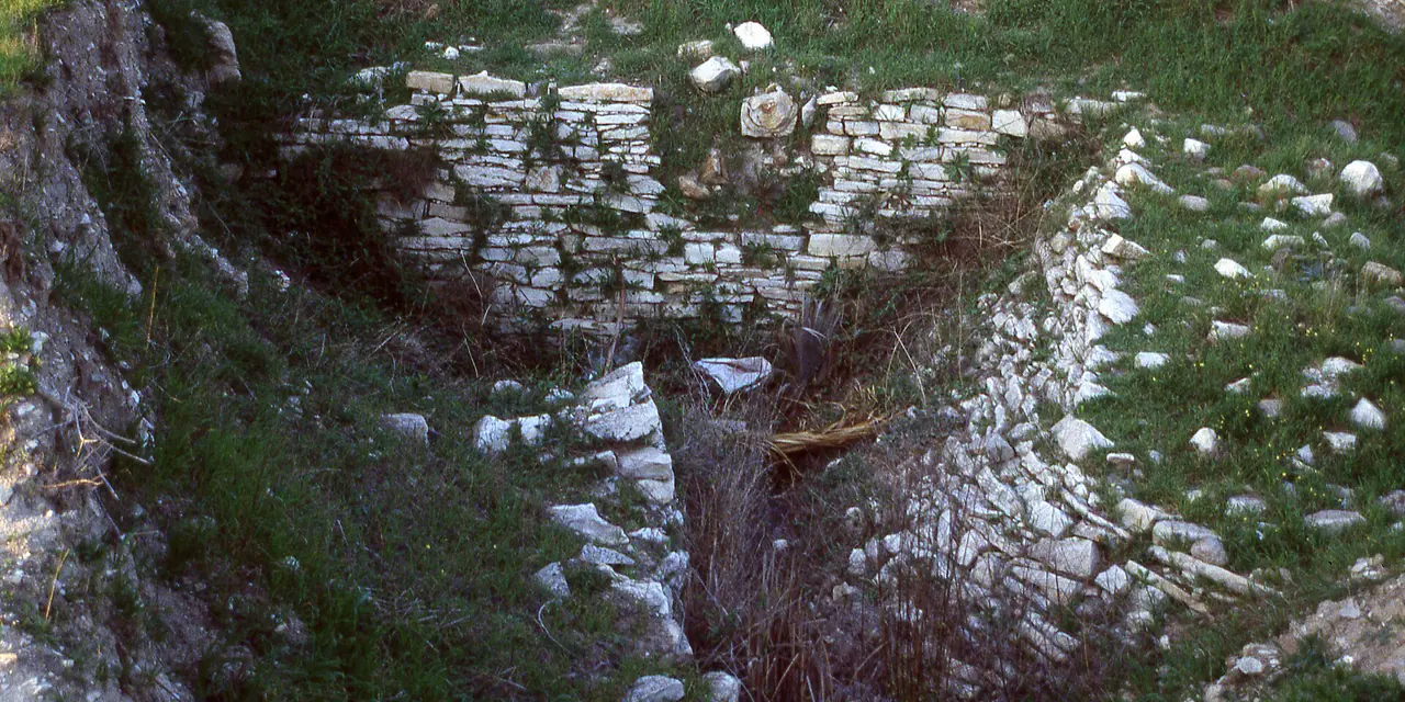
A sixth-century BCE olive-oil workshop at Urla İskele, beside Limantepe's earlier settlement layers.
 Photograph unavailable
İzmir · Ionian city of production
Making oil was part of city life
At Urla İskele, the Klazomenai olive-oil workshop makes visible the work behind a product. Olives are crushed and pressed, then the oil is separated from the remaining liquid. Established in the first half of the sixth century BCE, the workshop was abandoned around mid-century and rearranged in its final quarter. Its use ended around 500 BCE. These changes show how production was adapted to different needs.
Amphorae and the harbour's layers
Klazomenian amphorae stored and transported oil and wine. Making oil also meant making containers and preparing the product for journeys beyond the workshop. Nearby Limantepe's settlement reaches back to the fourth millennium BCE; the sixth- and fourth-century BCE harbour remains investigated underwater belong to later chapters in the coast's history. The earliest settlement and the submerged harbour structures do not share a single date.
Meeting Urla's olives again
Urla's olive groves and the agricultural cooperative's oil mill in Bademler bring production into the present. We can look at changing tools without assuming an unbroken chain from the ancient press to modern machinery. A project developed on the excavated workshop site in 2004–2005 brought it back into production, offering another way to understand the earlier working process.
From the workshop to the peninsula
At your next meal, consider the work behind the olive oil: processing, storing and transporting it all belong to its story. You can carry that question along the coast to Teos and Erythrai. Check current admission arrangements before visiting the archaeological site.
Layers of the place
How is the place situated?
Limantepe, the workshops, the grid-planned mainland settlement called Kyhton and Karantina Island are distinct places. The city's living areas shifted between them over time. Treating all the remains as one city plan from a single period would hide this movement.
How do the layers change?
Limantepe's occupation reaches back to the fourth millennium BCE; Klazomenai was founded in the Iron Age. Persian occupation and subsequent returns changed the settlement pattern. In the fourth century BCE, mainland Kyhton and the island assumed different roles. The workshops form just one part of this longer history.
How was the place inhabited?
Olive-oil workshops in the final quarter of the sixth century BCE connect production with rising prosperity. Obtaining a product requires tools and a sequence of work to be arranged together. That organisation offers another way into the city's past, alongside its changing rulers.
What can be said today?
A project developed on the excavated site in 2004–2005 returned the workshop to production. It brings archaeological traces into conversation with the process of making olive oil. Returning from the coast to Urla, you can read its olive groves and workshops as different times within the same landscape.
Connected stops
Stories that include this stop
Sources
- Kültür Portalı · Klazomenai Örenyeri
- Visit İzmir · Klazomenai üretimi ve amforaları
- Visit İzmir · Klazomenai işliğinin yeniden üretime alınması
- İzmir İl Kültür ve Turizm Müdürlüğü · Urla ve Klazomenai
- Ankara Üniversitesi ANKÜSAM · Liman Tepe
- Urla Kaymakamlığı · Urla coğrafyası
- Kültür ve Turizm Bakanlığı · Klazomenai ziyaret bilgileri
Frequently asked questions
Where is Klazomenai?
Klazomenai is presented in this guide as a ionian city of production in İzmir.
How can I find sources for Klazomenai?
The Sources section links to the evidence supporting this dossier.